It appears that I am still way behind on my trail-blogs. And while it seems just a bit strange writing about the trail adventures of last springtime, in some ways, or on some level, there may be some slight advantage to waiting this long, kind of like allowing a bottle of wine to age so the flavors can mellow out somewhat. Although this may sound like a ‘Steinbeckian justification’ and the blogs may be untimely in their publication, hopefully the subject matter, the mountain adventures themselves, will still be considered ‘relevant’. While I actually wouldn’t mind heading down to Perelli’s for a bottle of wine, or two (I am sure Pilon has got some good stories to tell), there are several trail adventures to tell you about, so let’s get on with it.
‘The Waterfall Tour’…
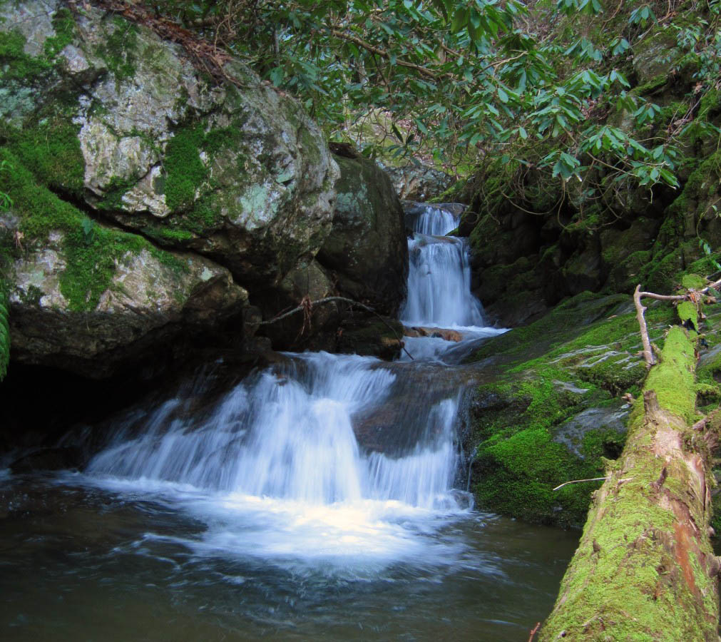
‘The Waterfall Tour’ is the name ‘Rat Patrol’ came up with over 20 years ago to describe the loop hike from Sill Branch around to Devil’s Fork, stopping at every waterfall along the way. Although some of the trails were primitive, even back then, during the old ‘trail club days’, this was a very popular hike, and we walked it several times with many people; some of these adventures were ‘epic’. Originally, when the loop hike was first conceived, it was a 12-mile hike to see 5 major falls bordering the Sampson Wilderness Area, but after learning the mountains a little better, we found enough shortcut trails to lessen the mileage to around 9.

Middle Devils Fork Falls aka Josiah Falls
Perhaps you may remember the blog about ‘The Devils Fork Falls’ (published December 2009 on this website) where Rat Patrol, his son Tyler and I hiked around and down the waterfalls in Devil’s Fork, accessing them from the ‘Longarm Branch Trail’. If you don’t remember (or haven’t read it yet), don’t feel bad, because I don’t remember it that well myself, except for the unbelievable log-buried trail we took over ‘Big Pine Ridge’ and how we climbed down the last 2 waterfalls and hiked out in the dark.

Log buried trail across Big Pine Ridge on the 'old route' in 2009
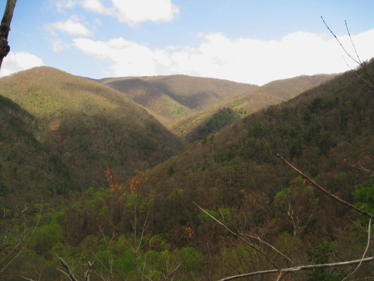
While wanting to hike the ‘tour’ from Sill Branch to Devil’s Fork and see all the waterfalls in there, without having to deal with that beastly trail over Big Pine Ridge, Rat and I studied our maps to find a better way. Rat is very good at translating maps, whereas I now rely not only on maps, but more on my ‘trial and error’ experiences, as well as the photos I have taken from various ridge-tops. The photos that I had taken from Longarm Ridge and Big Pine Ridge Knob (as well as some of the photos from Sampson Mountain) were very helpful in plotting the new route we planned to take, lessening the trail mileage to around 5 1/2 (difficult) miles.

The Big Pine Ridges and the Devil's Fork Valleys as seen from Longarm Ridge
While we were both in agreement on the route up and beyond Sill Branch, we did have several discussions about exactly which hollow we would take to descend into the Devil’s Fork, or even if we should attempt to hike down one of the steep, super-gnarly ridge-fingers, instead. Eventually, after more map and photo study, we had a plan.

'Sidewinder Cascades' along South Fork of Sill Branch
One of the fun things about the ‘Waterfall Tour’ is taking people who have never been there (on the top of the upper Devil’s Fork Falls, aka ‘Lillybeth Falls’), to the very edge of the cliff overlooking the falls, where by all appearances the trail, and possibly the entire world just ‘dead-ends’, pointing to the bottom and telling them we are going to climb ‘down there’, and watch the bewildered expressions on their faces. Indeed, it is a long way down–straight down.

View from the top of cliff above Lillybeth Falls
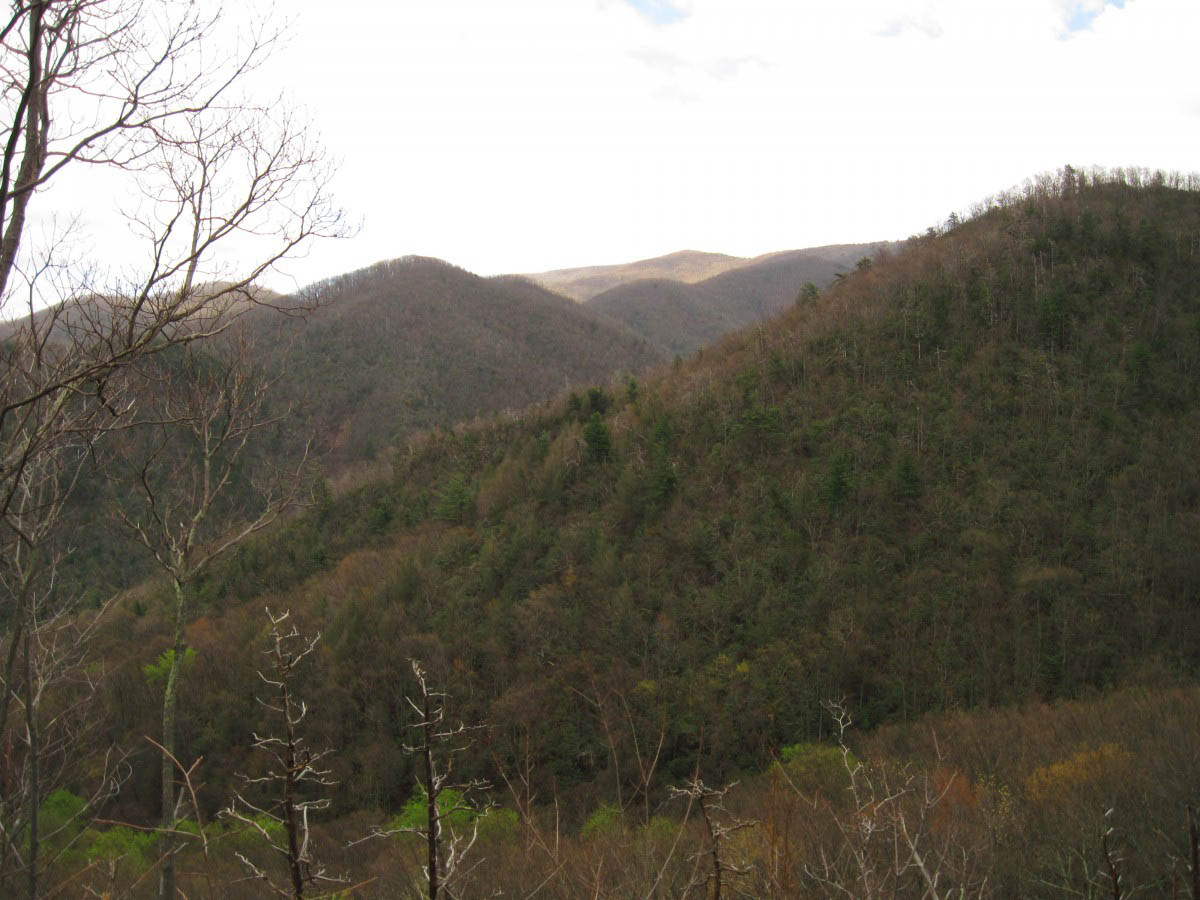
Our latest ‘victim’, Tyler probably remembered the abysmal trail over Big Pine Ridge and climbing down the waterfalls in the dark, as well, and decided not to attend the hike, apparently, but ‘Dan-o’ and ‘Fireball’, who had been hiking with Rat and I a few times, did. So anyway, about 9 am on a morning in April, we left a car at the Longarm Branch Trail-head and began our loop hike by walking down the gravel road to Sill Branch. Bypassing the upper Sill Branch Falls trail, we climbed the steep, yellow-blazed south fork of Sill Branch to the old roadbed below ‘California Fields’, which is named on the map as being ‘Willard’s Hump Road’. From there, we hiked on to where this ‘road’ met with ‘Forest Service Road 190’ at a place known as ‘The Big-R Curve’. We took a short snack/map study break at the ‘Big-R Curve’, wanting to make sure we descended off of the ridge in the right place. We found the hollow we had intended to take, and began our trail-less descent into Devil’s Fork.

Chosen route for the descent into the Devils Fork Valley
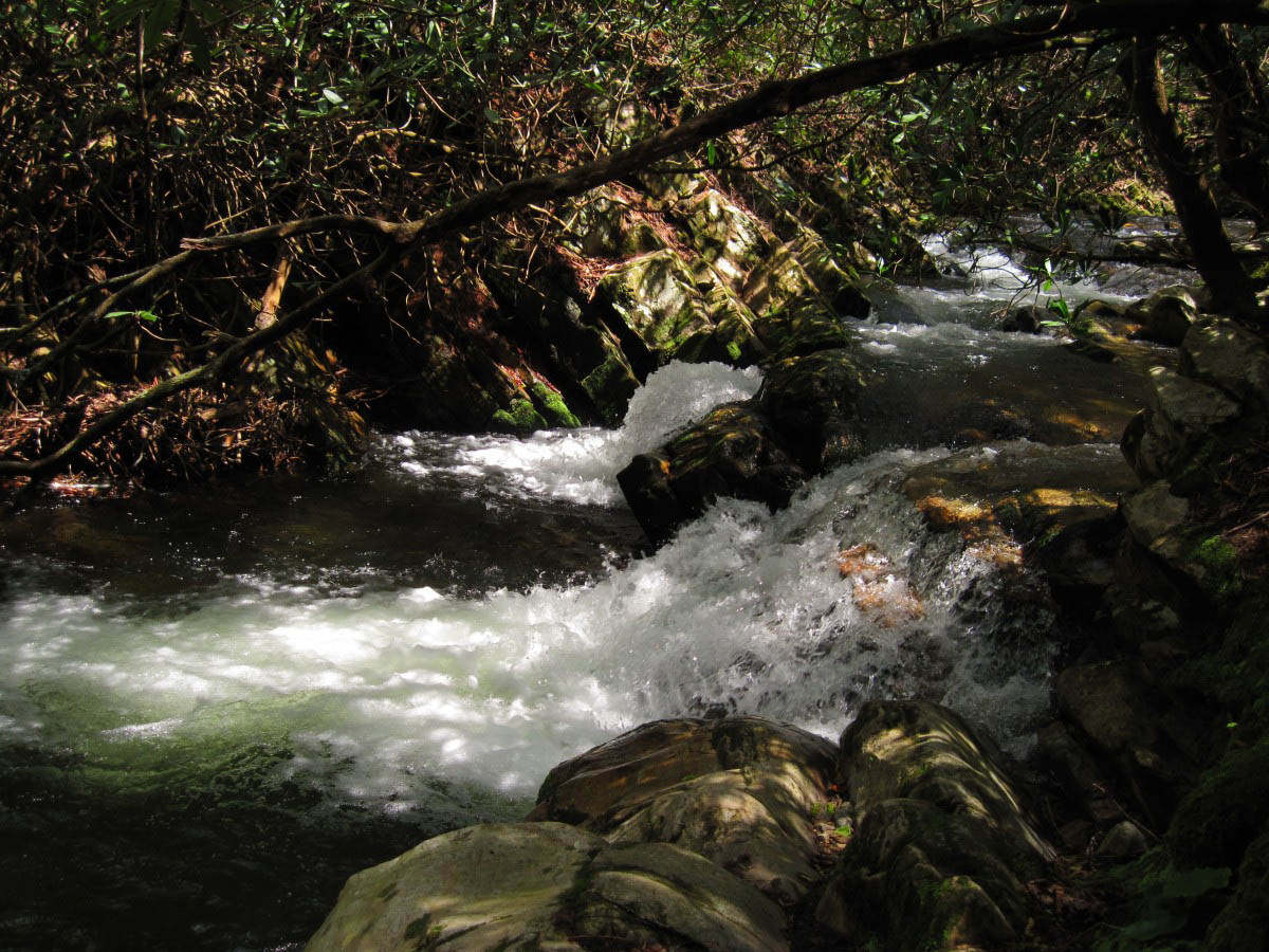
We hadn’t gone very far down when we encountered a rather significant cascade and a cliff. Being early April, the water levels were elevated, even this high up on the mountain. While the cascade was unknown to us, the cliff, I was informed by Rat, was the same cliff we would have fallen off of if Kep’s truck hadn’t of been caught by that little tree when he accidentally drove off the forest service road in the pouring rain many years ago (it is a long, twisted story, so I will leave it at that). The way to the bottom of the cascades and beyond was very steep, as well, what I like to call a ‘knee-knocker‘ trail, because tendons and ligaments tend to get sore and ache on extreme descents, such as this one.

Cascades discovered along the Upper Devils Creek
Continuing our steep descent, following the creek, the valley we had climbed down opened up and joined a larger valley, still well above ‘Lillybeth Falls’. This place was more familiar to Rat and I, as we had always went down to the falls through this part of the valley, accessed by the now tree-buried trail over Big Pine Ridge. Despite a tricky place in the trail, or two, we didn’t have any trouble getting to the top of Lillybeth Falls (aka, Upper Devil’s Fork Falls).

Water Log in Upper Devils Fork Valley
After Rat Patrol shocked Dan-o and Fireball with the usual ‘We are climbing down there’ routine, we decided to eat lunch on top of the impressive waterfall/cliffs, before meandering around and down the hidden ‘ninja trail’ to the base of the falls. From there, we continued our descent to the ‘Devil’s Slide‘ and the adjoining cliffs–which are actually two cliffs which allows the creek to form a rather large, open ‘gorge’ where the ‘slide’ is. It is much too dangerous to climb down the Devil’s Slide when the creek is ‘up’, as the rocks are steep and slippery, but there is a safe place to slide down the cliffs to the left.

Cascades just above top of Upper Devils Fork Falls aka Lillybeth Falls

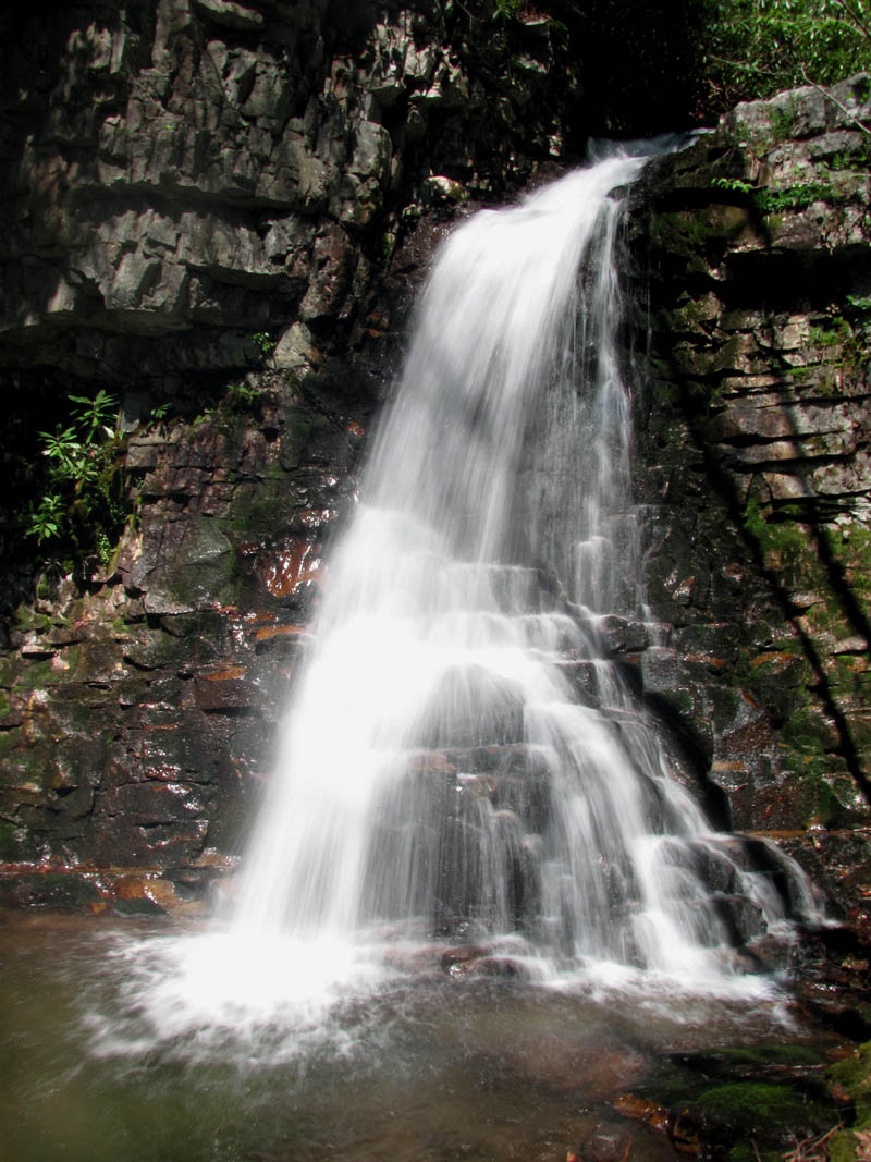
Upper Devils Fork Falls aka Lillybeth Falls
There was only one noteworthy ‘slide’ incident: On the next level of cliffs–below the “Slide’ and just above the ‘Middle Devil’s Fork Falls’ (aka, ‘Josiah Falls’) –“Fireball’, who admittedly has trouble on steep descents, slid too far too fast and almost wiped me, and her, out while I was standing on a narrow landing just above another drop-off into the rocky creek. I was attempting to ‘coach’ her down to the landing, but Instead of sliding down under control and grabbing the laurel limb, as I said, she slid down out of control and allowed the laurel limb to grab her. After that, Dan-o had to do a monkey-swinging maneuver to get around her and help her down the last 3 or 4 feet to the narrow landing. I pretty much stayed well out of Fireball’s ‘wipe out zone’ after that, which annoyed her, I suppose, but made for a few good jokes later on. Anyway, after crossing the creek (there is a split in the creek right above ‘Josiah Falls’), there is another steep, cliff-like encounter we had to deal with by sliding down to the base of the falls beside a massive fallen tree.

Devils Slide Falls

Falls on South Fork of Devils Fork Valley
We were all ready for another break after all the cliff-sliding maneuvers, and we enjoyed the ‘middle set’ of falls for quite awhile. The trail from there is quite mellow, compared to what we had encountered already, except for a tricky place at the top of ‘Pine Ridge Falls’. It is not so bad climbing around and down this rocky obstacle if you have done it a few times before (Rat, Tyler and I climbed down it in the dark the last time we hiked through here), but for someone who hasn’t encountered this seemingly impossible narrow, rock passage before, it can be a bit unnerving. Since it is the only way down, even people with acute acrophobia must deal with it.

Middle Devils Fork Falls aka Josiah Falls
All told, It was an incredible day of hiking; all of the waterfalls and cascades were fascinating and overflowing, while the cliffs were as primitive and alluring as the day they were formed thousands, if not millions, of years ago. We walked (perhaps limped a little) down the trail and back to the car like conquers, victorious explorers from a lost world, tired but happy.
Cascades below Middle Devils Fork Falls (aka Josiah Falls)

Pine Ridge Falls

Lower Longarm Branch Falls
Jones Branch Falls and Overlook…
On a sunny, warm day in late March, ‘Fireball’ and I went out for a hike in the ‘Jones Branch’ area. Although Fireball had hiked through here on the Appalachian Trail, she had never been to the Jones Branch Falls, or the Jones Branch Overlook, which is not surprising since neither of these places is well known, and the trails to them are quite primitive. Anyway, to make a long story short, we hiked up the Appalachian Trail to the waterfall trail. The last tenth of a mile to the falls is a trail-less bush-whack, but we made it through the dense laurels without too much difficulty. We reached the ‘lower’ set of falls first, a 10-foot plunge off a solid rock into a small pool in the midst of a thick stand of laurels. The main set of falls is just above and beyond. Although the path to them is appropriately rough, I really like these stair-stepping falls on Unaka Mountain. I remember when I first found them, quite by accident, several years ago; there has always been something about their seclusion and primitive nature that I found alluring and inspirational, and still do. These falls seem to have a spirit of their own, and I have always felt privileged whenever I visit with them.

Lower Jones Branch Falls

Jones Branch Falls
Just above the stair-stepping cascade is a fractured rock cliff-facing, the water cascades through a double-walled ‘chasm’ at the base of these cliffs and shoots out, following a recess in a seam of rock, for the most part, before dropping down the moss-covered wall, which is the main part of the falls. We climbed to the top of the falls so that Fireball could see the cascades and the chasm, which is pretty well hidden from below.

The Chasm - Jones Branch Falls

Jones Branch Falls
I’m not sure how, but I allowed her to talk me into climbing above the chasm with the cascades, following the creek further up that particular valley, and try to access the Jones Branch Overlook from there. Having done this one time several years ago, I knew that it was possible (the Overlook is on the prominent knob in between the north and south branches of Jones Branch). Supposedly, there used to be an old roadbed that went up and down that stretch of valley, and while it is still intact near the top of the knob and can be seen descending in switchbacks, it disappears before it gets near the creek in the bottom of the valley, apparently, since we were unable to find a trace of it, even. Although we failed to locate the old roadbed, we did see some other interesting things on our way up the creek-bed, such as a rather remarkable rock-spine, along with some gnarly trees and twisted vines.

Jones Branch Overlook

View from The Jones Branch Overlook

View from The Jones Branch Overlook
The ascent up the side of the knob to the Overlook Rock was a bit strenuous, but we eventually got there. We enjoyed the view from the prominent rock for a while before climbing the rest of the way up the knob to the old roadbed, which took us out to the other roadbed that intersects with Curly Maple Gap just above the shelter. From there, we followed the Appalachian Trail back down to the Jones Branch Valley, stopping only briefly to soak our tired feet in the cold water, before finishing our journey at the trail-head near the Nolichucky River.
Little Bald Mountain…
On a warm day in April (it was Easter) I started out at Spivey Gap and hiked up to the summit of Little Bald and back. Along the way, I encountered at least 20 northbound thru-hikers, several of whom decided to camp at Whistling Gap. Anyway, what was really impressive to me was how the entire forest floor on Little Bald was carpeted in red trillium, trout lilies, and spring beauties. It was a rather incredible sight.

'The Bluff' that overlooks the TN side on the summit of Little Bald
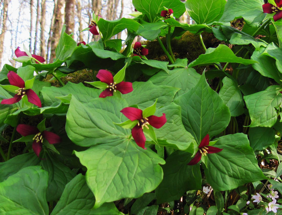
Red Trillium
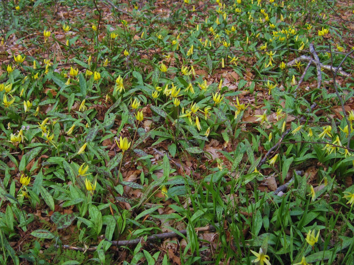
Trout Lillies
Old Forge Loop Hike…
In mid-April, I made plans to go mountain hiking with ‘Fireball’, and we ended up going into the Old Forge Area. Unable to drive to the trail-head at Jennings Creek, due to a locked gate (the Forest Service was building a new bathroom at the campground that day, apparently) we decided to park by the gate and walk the extra mile of gravel road to get to the Jennings Creek Trail. The sky was threatening rain and the air was rather cool when we began walking, but by the time we reached the first creek crossing on Jennings Creek, we were warm and the sky appeared less threatening. The creek was deep and cold and the cascades along the trail were very appealing. We chose to stay on the ‘Big Jennings Creek Trail’, which is the larger of the Jennings Creeks on the way in, but planned to walk the ‘Little Jennings Creek Trail’ on the way back down the mountain. Anyway, the creek-crossings were somewhat difficult because of the high water levels, but that is a good thing, since it is the creek that is most scenic through the lower section of trail.

Cascades on Jennings Creek
Cascades on Jennings Creek
Further on, we encounter a rather large brown and yellow mountain snake that was stretched out in the middle of the trail. After admiring this creature for a short while, we continued on to the ‘Cowbell Hollow/Poplar Cove’ trail intersection…basically the ‘Big Jennings Creek Trail’ becomes the ‘Cowbell Hollow Trail’ right there and begins to head up the mountain, while the ‘Poplar Cove Trail’ hooks back to the left toward the Horse Creek Campground. Taking the ‘Cowbell Hollow Trail’, we began our ascent up Round Knob. With the help of a few switchbacks in the trail, we were able to get a pretty good view of the Coldspring Mountain Ridges and the Jennings Creek Valley.

Brown and Yellow Mountain Snake
View from the Cowbell Hollow Trail
View from the Cowbell Hollow Trail
The air on top of the ridge was much, much colder for some reason, and by the time we had reached the picnic area at Round Knob, we had to put on all the warmest clothes we had with us at the time. The dramatic change in climate did provide some amusement, however, when we listened to the people who were filling several gallon jugs at the spring. Having driven up from the valley, they were still dressed in t-shirts and short pants, and were freezing.

Wild Iris

Cascades on Little Jennings Creek
To make a long story a bit shorter, we hiked back down the mountain using the ‘Little Jennings Creek Trail’, allowing us to loop back to Old Forge without hiking the same trail twice. The Little Jennings Creek was overflowing it’s banks and there were several nice cascades to look at along the way.

Cascades along Little Jennings Creek

Cascades along Little Jennings Creek

Cascades along Little Jennings Creek
Gentry Falls…
At the end of April, Dave, ‘the waterfall guy’, had a plan to drive up to Johnson County, near the Tennessee, North Carolina, and Virginia state lines to view a pair of waterfalls. Having never been there before, Rat Patrol, Fireball and I decided to ride along. It was a fairly long, but comfortable enough drive up past Mountain City, where we saw plenty of storm damage from the tornadoes that blew through the region. After only one wrong turn, we found the trail-head for the Gentry Falls.

Gentry Creek Falls

Cascades along Gentry Creek
It was warm and sunny, and the trail to the falls was fairly easy to navigate. The path was well traveled up the long, open valley, and there were blue blazes painted on the trees. The pathway to the falls was slightly uphill through the spring flora and with several creek crossings.

Lower part of Gentry Creek Falls

Lower part of Gentry Falls (Photo by RAT)
After about 2 miles of easy trail and rock-hopping the creek crossings, we reached a giant boulder. Just beyond this ‘dinosaur boulder’ were the Gentry Falls—two sets of admirable 40-foot waterfalls. It hadn’t taken very long to walk up to the falls, and since we had some time to spend, I decided to climb both sets of falls to get another perspective on them. It was just a bit tricky, but not too difficult. Rat decided to climb up there, as well, and we determined that the trail continues on beyond the upper falls on what appears to be an old railroad grade.

Upper part of Gentry Creek Falls
Upper Part of Gentry Falls (Photo by RAT)

Cascades that lead to top of the Upper Gentry Creek Falls
The return trip back to the trail-head was a long, downhill slope just about the whole way, and the only rough spot along the trail was where I slipped on a wet rock while attempting to cross the creek and fell in.

Ferns and Flowers
More adventures soon, I hope…
~~~~~~~~~~Boulderman 11-17-2011