
View of Big Pine Ridge Knob from Devils Fork Trail209 views(no zoom)Sep 20, 2026 at 09:38 PM
|
|
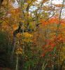
Autumn Scenery246 views2017Sep 20, 2026 at 09:38 PM
|
|

No Business Knob237 views11-6-2011Sep 20, 2026 at 09:37 PM
|
|
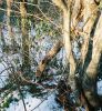
Old Log229 viewsGnarly Old Log on the 'Shinbone Rock' on Sugarloaf Ridge near Spivey GapSep 20, 2026 at 09:37 PM
|
|
View From Middle Spring Ridge Trail292 viewsView from gap--Obscured view of the Cassi Hollows and Rich Mountain.
12-3-2011Sep 20, 2026 at 09:37 PM
|
|

Frozen Falls in Laurel Gorge402 viewsGorge in Dennis CoveSep 20, 2026 at 09:37 PM
|
|
View from No Business Knob304 viewsLooking down into the Devils Creek Valley--the Stateline between Tennessee and North Carolina.
August, 2010Sep 20, 2026 at 09:37 PM
|
|

Apples217 viewsfound near Street Gap, 10-09Sep 20, 2026 at 09:37 PM
|
|

Swimming Hole247 viewsSwimming Hole in Clarks Creek where the Old Mill used to standSep 20, 2026 at 09:36 PM
|
|
View from Sampson Mountain239 viewsSill Branch and the 'meat-grinder' ridge where Rich and Embreeville Mountains butte together.
April, 2010Sep 20, 2026 at 09:36 PM
|
|
Lower Sill Branch Falls230 views3-11-2011Sep 20, 2026 at 09:36 PM
|
|
Cascades on Horse Creek303 viewsNear where Squibb Creek flows into Horse Creek.
12-3-2011 Sep 20, 2026 at 09:36 PM
|
|
| 1530 files on 128 page(s) |
 |
|
|
|
|
37 | |
|
|
|
|


