 |
Last additions - Sill Branch Area |
 |
|

Old Log Road at Spring260 viewsSpring and old log road after exiting Meatgrinder ridge. This is actually where one of the main sources of North Sill Br.bubbles out of the ground.Apr 24, 2009
|
|
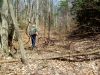
Old Log road at Spring271 viewsFind Bol'Dar marking the place with a rock where we came off the ridge for future reference. (little did he know at that time how much he was going to need that, lol) Apr 24, 2009
|
|

Old log road and spring229 viewsLooking back where we came off Meatgrinder Ridge to the old log road/springApr 24, 2009
|
|

Snakehead rocks233 viewsNear lower falls trailheadApr 24, 2009
|
|

Ridge Boulders262 viewsNear lower Sill Branch Falls trail-headApr 24, 2009
|
|
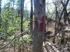
Red Tree on Meatgrinder Ridge 'trail'229 viewsBastard Blazing ?Apr 24, 2009
|
|

North Fork Sill Branch222 viewsForgotten falls above the upper falls...
photo by RatApr 24, 2009
|
|

Clarks Creek 231 views...Swimming hole
Photo by RatApr 24, 2009
|
|

Clarks Creek227 viewsPool of water in creek at the old mill site just beyond Embreeville Mountain.
Photo by RatApr 24, 2009
|
|
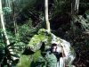
Camo Rat Rock242 viewsFind Rat
...On the way to the Sill Branch Overlook. Apr 24, 2009
|
|

Clarks Creek227 views'Peters Hole" swimming hole
Photo by RatApr 24, 2009
|
|

Backway to Sill Branch Overlook228 viewsLooking down where we just came from Apr 24, 2009
|
|
| 133 files on 12 page(s) |
 |
|
|
|
6 | |
|
|
|
|
|


