 |
Most viewed - Sampson Mtn. Wilderness Area |
 |
|

'Boney Knuckle Knob'235 views...with the 'Monkey-Head Rocks' cliffs, as seen from Big Pine Ridge Knob...
January 2010
|
|

View From Longarm Ridge235 viewsThe 2nd Big Pine Ridge Knob (aka, 'The Pyramid') and the "Meat-grinder Ridge' that overlooks Sill Branch in the distance.
November, 2010
|
|
Flood Waters in Clarks Creek235 views2-23-2019
|
|

Clarks Creek234 viewsMarch - 2009
|
|

Sampson Mountain234 viewsHiking the ridgeline, back when it was possible
Photo by Rat, late 1980's
|
|
Views from Big Pine Ridge233 viewsThe rock/spine ridge rising up 'The Volcano' (Big Pine Ridge Knob #1) in the forground, Longarm Ridge in center-left, and part of Sampson Mountain behind them all...
January 2010
|
|
Small Cascades233 views..along the 'Embreeville' trail,
3-19-10
|
|

Longarm Ridge232 viewsThe 'Knife's Edge' leading to the top of Rich Mountain,
1-1-2010
|
|
View from Sampson Mountain232 viewsSill Branch and the 'meat-grinder' ridge where Rich and Embreeville Mountains butte together.
April, 2010
|
|
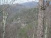
Views from Big Pine Ridge231 viewsAnother angle of the Sill Branch Overlook.
January 2010
|
|

Big Rock on 'The Volcano'231 viewsThis big 'turtle head' boulder overlooks the 'half-pipe hollow' from near the top of Big Pine Ridge Knob.
January 2010
|
|

View From Longarm Ridge231 viewsThe Big Pine Ridge Knobs, with the 'landbridge' connector in between, and the 'Meat-grinder Ridge' that overlooks Sill Branch in the Distance.
November, 2010
|
|
| 236 files on 20 page(s) |
 |
|
|
|
|
13 | |
|
|
|
|


