 |
Most viewed - Sampson Mtn. Wilderness Area |
 |
|
Confluence285 viewswhere Sill Branch joins with Clarks Creek,
3-11-11
|
|

Big Pine Ridge Knob283 viewsaka, the 'Volcano',
1-1-2010
|
|
Rock Strata283 viewsDave and Rumo,
Buckeye Falls Trail,
3-22-2014
|
|
'The Gorge'281 viewsView of cliffs in the 'gorge' below Lilybeth Falls where the Devil's Slide is.
November 2009
|
|
Lower Sill Branch Falls281 views3-11-2011
|
|
Dan280 viewsClimbing left side of Buckeye Falls,
3-22-2014
|
|
Clarks Creek279 views3-11-11
|
|
View from Big Pine Ridge Knob278 viewsView from 'The Volcano'...the right forks of Sill Branch on the left, and the 2nd knob ('The Pyramid') straight ahead.
January 2010
|
|
'The Pyramid'278 views...and the connecting 'landbridge' as seen from Big Pine Ridge Knob #1 ('the Volcano'). Sill Branch is on the left, Devil's Fork on the right.
January 2010
|
|
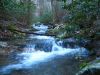
Cascades On Sill Branch278 views3-11-11
|
|
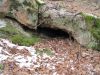
Small Cave277 viewsin Sill Branch area...
Wonder if anything lives in there?
January 2010
|
|
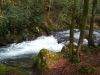
Cascades On Clarks Creek277 viewsnear swimming hole,
3-11-11
|
|
| 236 files on 20 page(s) |
 |
|
4 | |
|
|
|
|
|
|
|


