Has it been hot? Oh, yeah…
Way back, when I was still in High School, I had a job delivering newspapers. There was this one ol’ fellow on my route that I would see almost every day, as he and his be-sweatered Chihuahua awaited my inevitable arrival so he could impart some important new wisdom upon me. He and his wife were good people, but the funny thing is, what I remember most about him, is how he was always grumbling about the weather. It was always either too hot, too cold, too wet, too dry, too something—always. As a friend of mine recently pointed out, a positive attitude is a valuable asset; just once I would have like to have heard him say, “Wow, what a great day!’ I learned that it was best to just agree with his dissatisfaction, but I suppose that through it all, despite his atmospheric discontent, I also learned to appreciate the subtle variations of weather, and have tried to refrain from making any negative remarks in that regard, and instead will leave that sort of business to the weather prognosticators and aficionados (aka,‘weather orcs’), after all, this is a hiker-blog, and not a weather-blog. In other words, I have decided to spare you my essay on ‘global warming’, Al Gore, and the price of tea in China, and will now get on with the recent trail adventures, instead…
Jones Branch Overlook…
I suppose the most ambitious trail escapade of the summer (so far) was the hike to the Jones Branch Overlook, a quite scenic cliff-boulder overlooking the peaceful Jones Branch, where the Appalachian Trail ascends/descends the southernmost ridges of Unaka Mountain near the Nolichucky River. From the secluded overlook, there are also some very good views beyond the river gorge, out to the Bald Mountain Chain of the Appalachians. I accidentally found the overlook a few years ago, perhaps after a Jones Branch Waterfall adventure, and have been going back every year since. My hiking buddy, ‘Rat Patrol’ had had never been there, however, and despite some sore ribs from a recent motorbike accident, decided to brave the elements (mostly heat and ‘bugs’) and check out the overlook.

View from the Jones Branch Overlook
The plan was fairly simple: We left a car at the trail-head near the Nolichucky River Campground, and drove up and around the mountain to ‘Indian Grave Gap’, where we began our hiking journey. The first 4 miles to ‘Curly Maple Gap’ went rather quickly, and without too much misadventure. Then we began our side-trip to the overlook, ascending the old gap trail to the fork, and hiking out the seldom-used trail on the large, rugged knob that is positioned between the north and south forks of the Jones Branch. We had to descend the face of the knob (it was very steep) about a tenth of a mile (perhaps a little further) to get to the rock overlook. The views were nice–Big Bald was visible when we first arrived, but a cloud rolled over the mountains from North Carolina, and obscured part our view to the south. This same cloud tried to rain upon us, but it was so hot at the time, that the raindrops mostly evaporated before reaching us, showering us in a cool, refreshing mist, instead. We lounged about upon the exquisite rock cliff, listening to the relaxing sounds of the waterfalls far below us, for as long as time would allow, and then retraced our steps back up the steep face of the knob, and (after investigating some of the other intriguing cliff-boulders that inhabit the side of the knob) made our way back to Curly Maple Gap.

Bol'Dar on the Jones Branch Lookoff
We met a thru-hiker at the shelter there, a fellow named ‘Heavy Metal’ from Detroit, and we stopped for a while to talk with him before descending the Appalachian Trail into the Jones Branch. I couldn’t resist climbing up onto the large boulder-spine that buttes out of the side of the ‘Johnson Rock Ridge’ since ‘they were there’; Rat was a bit reluctant to follow, but managed to climb up and get one last view of the mountains before climbing back down. I inexplicably ‘wiped out’ on my way down off of the rock spine, and sprang a leak in my arm. It was nothing serious, however, and we continued on down the trail, finishing our 11-mile hike at the river, where Rat’s car was waiting for us. Somewhere along our trek, I apparently encountered a herd of chiggers, which was rather unpleasant, but not earth-shattering.
Flint and Coldspring Mountains…
There was another rather ambitious hike to Coldspring Mountain: In early August, I drove up to Devil’s Fork Gap along the Tennessee—North Carolina state line. The air smelled just like perfume at times, as I began hiking the Appalachian Trail south towards Flint Gap and Coldspring Mountain. I had hoped to hike all the way to the ‘Big Rock’ on top of Coldspring, but having gotten a late start (which isn’t very unusual) only made it as far as the Shelton Memorial. The climb out of Flint Gap up the Coldspring Ridge has always kicked my butt—even 20 years ago when I had slightly more spring in my step and a bit more endurance.

Flint Mountain
It was a really hot day, mid-90’s, I would say, but I did fairly well, at least until I eventually ran out of steam about a football field down from the top of the ridgeline. After a sandwich break and some water, I made it the rest of the way to the top, and on to the Shelton Memorial, where I rested some more and enjoyed the peacefulness of the Civil War Graves Memorial site.
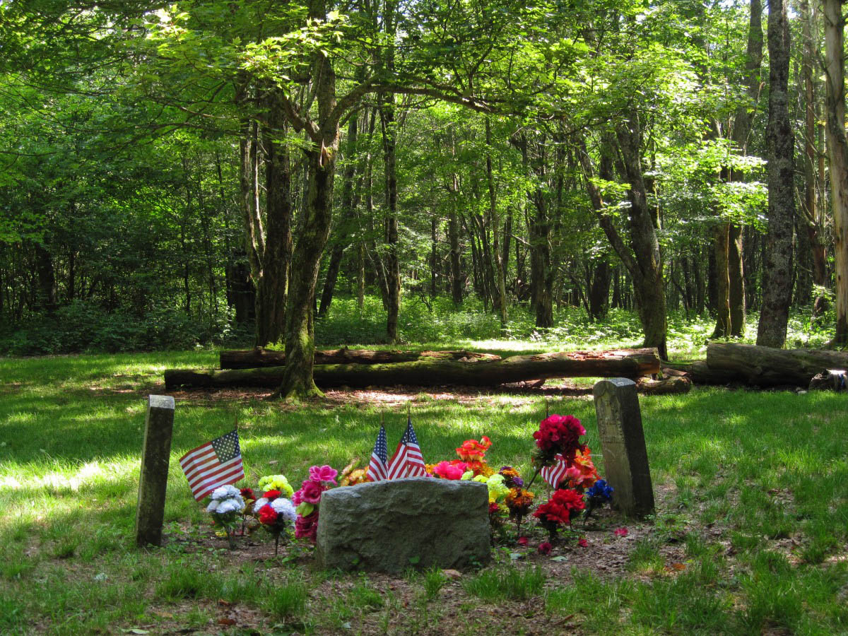
Shelton Graves / Memorial
I can’t help but wonder how and why these young men, kids really (one of them was only 13 years old), were killed, who they were and what they were like. It seems like such a waste, ambushed and killed for no good reason, in the prime of life. Surely the ambush party could have done things differently, but I suppose we will never know the whole story of what happened that night on the mountain. One thing is for sure–it wasn’t good. There are some very old trees nearby that may have been saplings 150 years ago when all that bad stuff was happening there—and they are still standing as witnesses…if only trees could talk.
Roan Mountain High Knob Trail…
Near the end of July, I went up to Roan Mountain and hiked up to the summit from Carvers Gap. Somehow, I had strained a calf muscle a couple of days beforehand, so I took my time climbing the hill, enjoying the scenery as much as I could. It was a nice day and the views across the gap to the balds were pretty good, although there were several noisy people yelling back and forth, which I could hear all the way across on the High Knob. I also encountered several hikers on the way up the trail and a cool stealth-rabbit that decided to pose for my camera. The air smelled fresh, having rained just before I arrived, apparently, and the balsams always seem to smell good, as that is their nature.
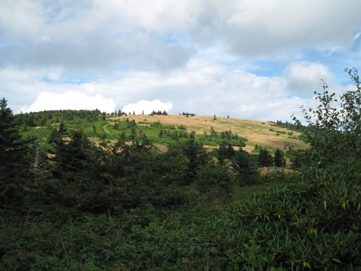
Round Bald
It had been quite a long time since I had visited the shelter (the old Fire Warden’s cabin, back when there was still a fire-tower there) at the High Knob, and was glad to see that it had been repaired—the floor was rotted out and mostly gone the last time I remember staying there. It looked to be in pretty good condition; however, there were an inordinate number of flies clustered in front of the shelter for some strange reason, which would rise up and buzz around if disturbed from their headquarters around the fire-pit. The rocks above the shelter, the highest point on Roan Mountain (elevation 6,285’), made for a pleasant lunch venue before hiking back down the trail to Carver’s Gap. I saw a few deer in the State Park as I was driving through there, but couldn’t stop to take any photos, since there were a couple of cars behind me at the time.
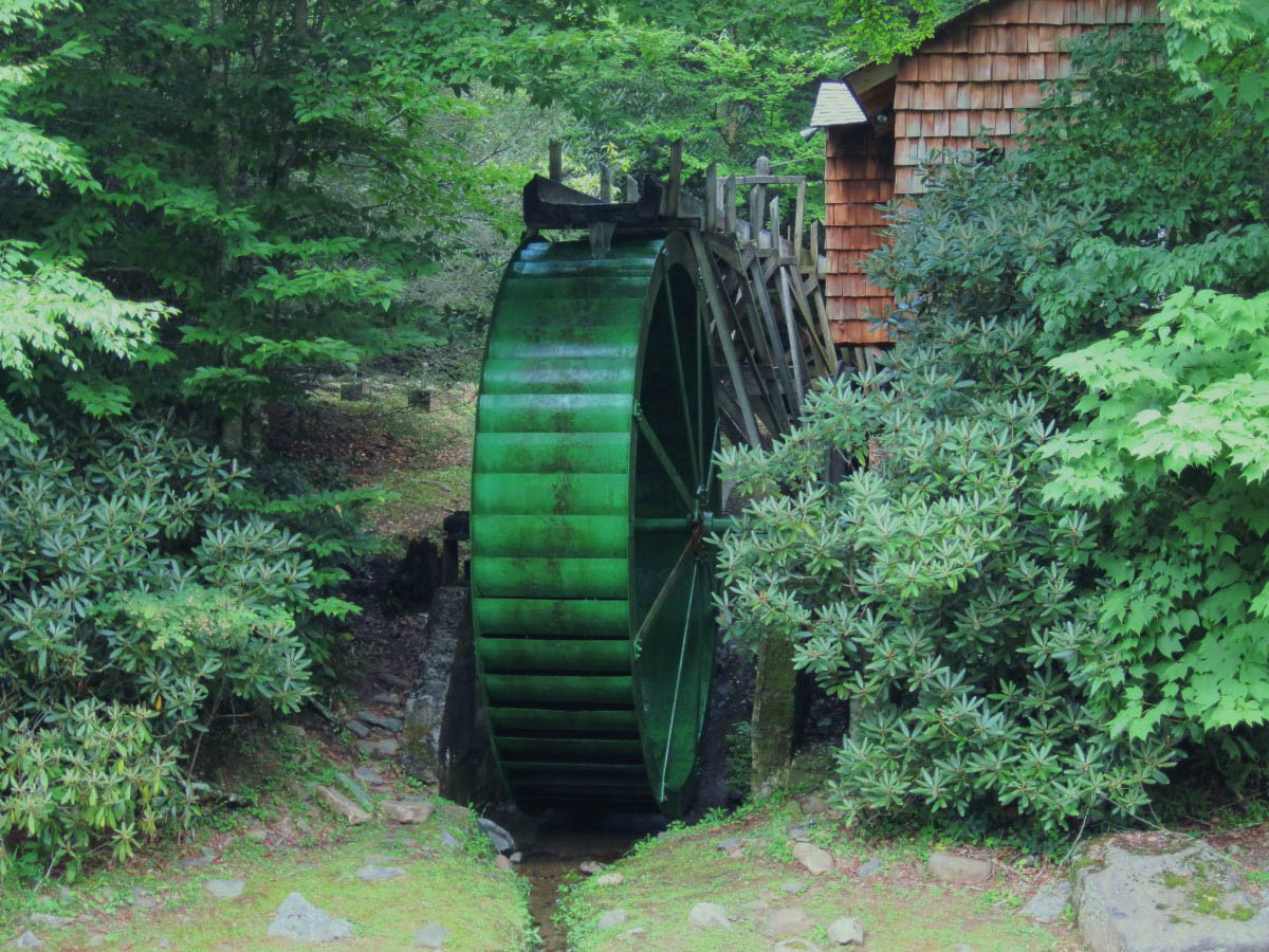
Waterwheel at Roan Mountain State Park
The Spivey Gap Adventures…
There were 3 hikes starting out of Spivey Gap; the first trip in mid-July found me waiting out a fast moving rainstorm beneath the colossal ‘High Rocks’ on the Appalachian Trail. I was rained on again before I could get back to Spivey Gap, but it felt refreshing, and I didn’t mind at all. The second trip, in mid-August, was interesting, as I decided to trek up the old Forest Service Road (the Pisgah National Forest Service does a good job maintaining their forest service roads) to Whistling Gap. I saw a grouse pretending to be wounded, and while checking that out, I walked up upon a rather large wild turkey, which sprung out of the brush beside the freshly mowed meadow, and somewhat startled me. With a perfect camouflage, I never would have seen her if she hadn’t of jumped out of the brush—they are very ‘stealth-like’ when they want to be. Anyway, I hiked on to the Whistling Gap and enjoyed the peace and serenity there and also re-discovered the mysterious ‘rock mound site’, which I haven’t been able to explain as yet. Perhaps it was an old homestead at one time. Despite the road having been mowed, my boots were water-logged by the time I returned to the Spivey Gap, and they needed a few days to dry out before the next trip.

View from below High Rocks
The 3rd, and most recent trip to Spivey Gap was a rain adventure out to ‘Devil’s Creek’ and ‘No Business Knob’. I met a friendly, young woman, with her 2 dogs, on a section hike near ‘Devil’s Creek Gap’, and watched her disappear into the thick cloud that engulfed us before descending down the old trail into Devil’s Creek. It was already raining somewhat beforehand, but I hadn’t gotten very far down the trail before the rain began pouring down upon me, as if out of a bucket. I was trying out an old umbrella as a rain deflector, which was a bit awkward, but stayed fairly dry huddled up beneath it, hoping to wait out the storm. After 10 or 15 minutes crouched beneath the umbrella, however, my knees began to complain, and I eventually decided that since it wasn’t going to quit raining anytime soon, to put on a raincoat (which wasn’t much help) and continue hiking down into the Devil’s Creek Valley.
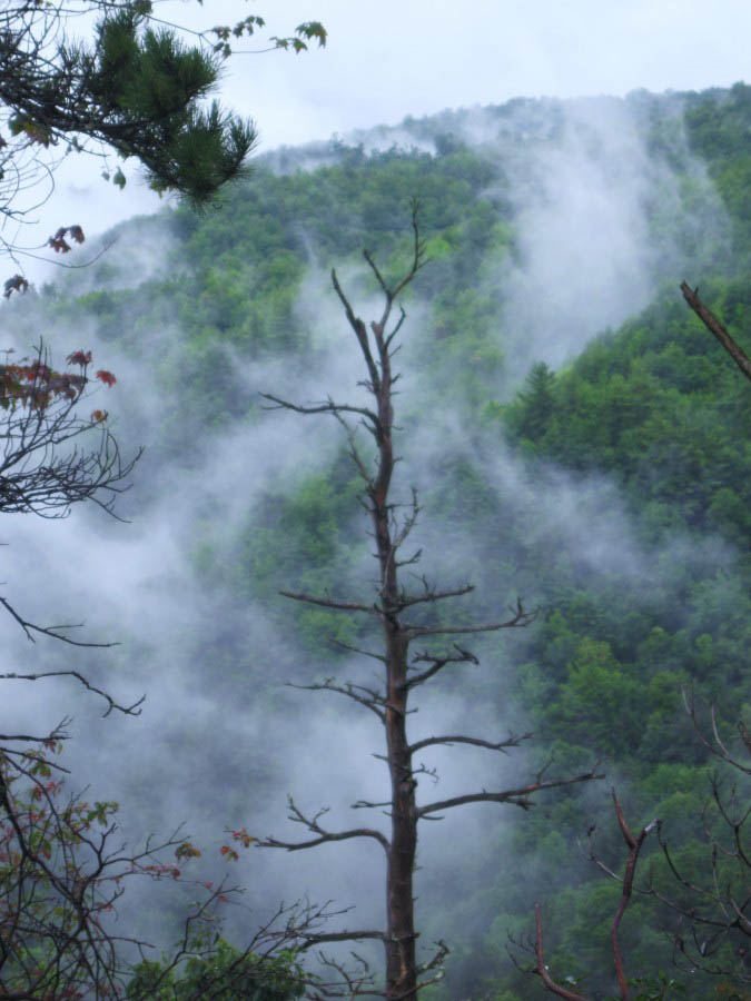
Devils Creek Valley from No Business Knob
The trail wasn’t maintained, and there were several large patches of stinging nettles, which are unpleasant (I was wearing shorts), and also areas where the laurels have taken over the old roadbed. After about a mile of this wet, amusing trail, when the laurel hells and nettles began to appear even thicker, I decided that this hike would probably be better in the winter, when the nettles (and perhaps a few other creatures) would be in hibernation. Anyway, I hiked back up to the Appalachian Trail, and wandered out toward the shelter on No Business Knob, hoping to get a view of the river gorge. I guess my adventure level was still a bit low, however, and, having seen a rock ledge above the trail, decided to climb up the pathless ridgeline to get a better view. I didn’t climb to the top of the knob, but did climb high enough to get a quite good view of the Spivey Gap area and Flattop Mountain, although the clouds were way too thick to see Little Bald, or Big Bald in the distance. Of course, the shredded clouds floating up the valley and ascending the sides of the mountain was a good part of the charm—it looked rather amazing.
Sampson Mountain Wilderness…
I don’t go into the Sampson Mountain Wilderness as often as I used to in the summertime; it can be rather depressing to see the creek in such a state of decline, and summer is also when the blood-sucking, and kamikaze eye-orcs, become thick as clouds. It can be rather irritating. Despite all that, I took a hike up back into the wilderness one day in early August. The creek was barely running, and I did get a few gnats in my eyes, but there was no danger of getting my feet wet at any of the creek crossings while I walked out toward Buckeye Falls. I didn’t go quite that far, however, but I did make a few notes concerning old roadbeds leading up onto Sampson Mountain for possible future exploration, but the thing that impressed me the most about this hike were the tall, colorful cardinal flowers that were blooming next to the creek in places—they seem to thrive there.

deep pool in Clarks Creek
A Few More Hikes…
My friend, ‘Grasshopper’, was in town for a few days and we went out for a couple of mountain hikes. We managed to get soaking wet on the trail near Sam’s Gap (well, mostly I did, since she had a raincoat), but it was refreshing, and we succeeded in having fun anyway. We were also rained on during a hike up to Sill Branch Falls, but again, we had quite a lot of fun, at least until the lightning and thunder made us retreat to the car.
As always, many thanks to the Web-Wizard for all the good work on the website. . Likewise, thanks to Rat Patrol for all the impressive Roan Mountain photos, and everyone else who has sent in photos, or takes the time to read this trail-blog, especially if you read it all the way to the end.
More adventures soon, as we prepare for the 2010 version of ‘Rat’s Birthday Hike’…not quite sure where we are going yet, but it should be an adventure.
~~~~~~~~~~~~~~~~~~~~Boulderman 8-24-2010